NA Motorcycle Ride - 2006

This blog is to document a motorcycle trip through western North America in 2006. Tentative schedule is to leave Houston, Texas on June 28, 2006, traveling first to the Grand Canyon, then through Utah to Glacier National Park, to Banff, Calgary, and then on the Alaskan Highway to Anchorage; return routing using the Alaskan Ferry system to Prince Rupert, B.C., returning down the Pacific coast, through Shasta NF.

My Photo
Name:
Location: Beverly Hills, FL, United States

Wednesday, August 16, 2006

TRIP SUMMARY


NA Motorcycle Ride - 2006
(Click to enlarge)


U.S. Route - Lower 48


Canadian Route


Alaskan Route


SUMMARY:

Miles: 12,879
Mileage: 40.76 mpg (over 30 recorded fillups)

Days: Total days toward objective - 36 (Day 10 was a backtrack due to mother's illness)
Rain days - 23 (64%)
Clear days - 13 (36%)

Great days - 36

States/Provinces/Territories Visited:
U.S.A. => 13 (TX, NM, AZ, UT, WY, MT, ID, AK, WA, OR, CA, NV, CO)
Canada => 3 (Alberta, British Columbia, Yukon Territory)


Thanks for all who rode with me through the blog. I now know what it means to be a reporter with deadline...and it's not good. But it was worth it.

Last Day (37th) - August 16, 2006 - 507 Miles Childress, TX - Spring, TX

Childress, TX - Spring, TX and home

Wouldn't you know it. One of the few mornings on this trip when I didn't automatically wake up before the roosters, and the alarm clock went off at 7:30 a.m. I didn't check it last night, just as I haven't set an alarm for 37 days. Sure enough, it was set. I was waking up without alarms because, like a kid before Christmas, I was eagerly looking forward to see what the next day would bring. That pretty much says how great this trip has been for me. I didn't eagerly awake today because I knew it would be the last day and I wasn't (and still am not) ready for this to end. So...I was sleeping in when the damn thing sent me about three foot off the bed.

With acknowledgement to Robbie Burns ("The best laid schemes o' mice an men gang aft agley"), I didn't take Hwy 6 as planned. Toward the end of yesterday's ride I noted the bike was running a little rough. I decided I may have a slightly fouled plug so I decided to change them. I'd originally packed two plugs in my tool kit but, when I looked I only had one. Not wanting to change one plug (even if only one was slightly fouled...that would probably have indicated a worse problem), I decided I wanted to change both. Can't explain this logically, I just get the now-and-again anal retentive thought and act on it. I couldn't find the correct plug in either Childress or Quanah so I plugged on (pun intended) to Wichita Falls where I got a plug and changed both. Both old plugs appeared quite good for running something like 23k miles, not burning rich, or really fouled. After replacement, the bike did run a little smoother, but there is still a slight vibration at around 75 m.p.h. that I don't think was there before. Of course, it could be the tires also...we'll see.

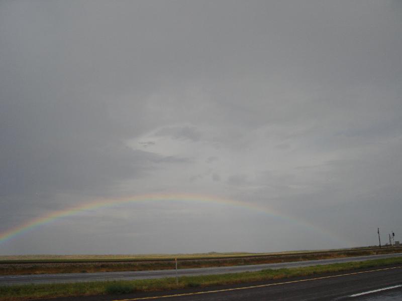
In any event, my ride down to Wichita Falls forced me into the Ft. Worth-Dallas-Houston interstate maze. I was also reminded what it means to ride in Texas in August. Remember when I was bitchin' about the cold and rain in Alaska? How about yesterday when I just had the rain? All those complaints are withdrawn. I'd have taken yesterday's weather in a heartbeat today. At least it wasn't hot running through those showers. Today was HOT! Dante hot! It was well over 100 degrees and I had to stop about every hour to drink water. That worked, but it was hard riding.

In keeping with my policy to make lemonade whenever required, this route, at least, took me by Woody's in Centerville. Centerville is at mile marker 164 on I-45. And Woody's? Just the best jerky on the planet. Woody's has every kind of jerky you can imagine. It's called the jerky capital of the world. (I thought that was Washington.) Anyway, I stopped in and got some turkey, elk, and buffalo jerky. I thought elk was the best ever until I tasted the buffalo. That was far and away the best I've ever eaten. (No wonder those Indians fought the railroad so hard.)

The problem is how to set it up so you can eat while riding. I stored the majority in a saddlebag, but put some in a plastic bag in my tank bag, strategically placed so I could pull the jerky out one piece at a time with the left hand. That worked fine and I motored my way toward Houston fat, dumb, and happy, just munching away...right up until the last piece. The last piece, it turned out, was small, about three inches long and one-half inch in width. It sort of got hidden in the plastic bag and popped out and up, when I groped through the bag to retrieve it. I'm trying to grab the jerky and the, now, flapping and flying plastic bag, all while riding a motorcycle safely at something like 80 m.p.h. Did it work? Yep. The key is not to panic in these situations...well...that and luck. The wind pushed the jerky up and over to the right side of the gas tank, and it just sort of settled in there, between the tank and the windshield, levitating like a David Copperfield trick card, about two inches above the tank. I managed to stuff the plastic bag back into the tank bag and zip it up, then reached for the jerky. Ah, but that changed the aerodynamics of the jerky levitation trick. When my hand entered the currents supporting the jerky, my luck held though. The jerky lost altitude and, instead of falling off to the inevitable hardtop and required expletive, it fell down on the tank and lodged between the corner of the tankbag and the tank. Knowing luck when I see it, I picked it up and calmly placed it in my mouth; all the while watching the road in front of me and safely negotiating the traffic. Nah!!! Got lucky and lived, and ate, through it!!

After eating all the available jerky I pulled into the house at about 7:30 p.m. tonight ending the most exciting, adventuresome, and trying vacation of my life. Sadly. If I could I would gladly pull out tomorrow for an equivalent trek somewhere else.

Tuesday, August 15, 2006

August 15, 2006 - Day 36 - 490 Miles Grants, NM – Childress, TX

Grants, NM – Childress, TX

Left Grants in the familar raingear. Managed to get through Albuquerque dry but then the rains came. There were storm cells spread out all across the north and north east in a large band. By the time I got to Santa Rosa they were all around, and over me. The intensity varied considerably from light to heavy, with the heaviest waiting until I was in a very long road repair section near Tucumcari. Then it poured. My shooter’s glasses fogged up in the heaviest rain, adding insult to injury; I had to ride at 70 mph with the glasses pulled down on my nose creating a small slit between the top of the glasses, and my helmet. No one, repeat, no one, was slowing down for the construction because the crews had pulled in with the weather. I would have too except there was no where to do so. So, I just grinned (actually, screamed curses) and bore it.

At least the rain gods saw clear to send me a rainbow once in Texas.

Rainbow just north of Childress, TX


This was boring interstate riding at its worst. In case you haven’t figured it out: I’m pulling for home at this point. I am going to take Hwy 6 from Quanah tomorrow and ride it down through Waco and on into the Houston area. I’m familiar with the Waco-Houston stretch, but have never been in the northern end of Hwy 6. It has to beat the Ft-Worth-Dallas-Houston mess they call I-35/I-20/I-45. In any event, it’s new road. Hope the rain lets up. As I write this in the motel room, it's still raining outside. Bet when I get home my roof leaks.
Summary to date is now:
Rain day – 23 (66%)
Clear day – 12 (34%)


Donley County Courthouse - Clarendon, TX

I took this because last October I came through here on a trip to Palo Duro Canyon and snapped this courthouse. When I got home only three of about fifty pictures were still on the "memory" stik. It's a neatly restored old courthouse.

Monday, August 14, 2006

August 14, 2006 - Day 35 - 496 Miles Springville, UT - Grants, NM

Springville, UT - Grants, NM

Great ride up Price canyon this morning (Hwy 6). Early morning temperatures are still rather cool once you get up around Soldier Summet (7450+ ft), but warmed up quickly enough. Radical change in scenery between Price and Moab, a distance of only 115 miles. You go from high mountains and high valleys to real desert and red rocks, ala Arches National Park. Moab is a neat little green-spot town in the middle of the desert.


Price Canyon between Soldier Summit and Price


Between Price and Green River, UT


Nice little roadside arch just south of Moab, UT


Hoped to have lunch with my friend Melody P., but was unable to contact her. Totally my fault. I should have called last night but didn't know if, or what time I would get through there so, like the dummy she called me in her phone message this afternoon, I waited until I hit Green River, only 70 or so miles away, to call. It turned out we missed connecting by only about fifteen or twenty minutes. She returned my call but I'd already decided we weren't going to be able to meet so I'd grabbed a quick lunch and hit the road out of Moab. Unfortunately, she called right after I left and I turn off the phone on the road because 1) I always run the charge out of it, 2) I can't hear it ring while riding, and 3) evidently, I can't feel it vibrate while riding. So why have it on? My bad.

Anyway, had a great lunch in Moab at a place called, I think, Pasta Joe's. The lunch pasta was "Green Chilli Ravioli." It was ravioli with jalapenos in them!!! Now who could possibly turn that down? It was as good as it sounded...multiple times.

Left Moab and started running into rain showers from Monticello, UT on into Grants, NM. As usual, the bike ran great and just chewed up the miles. Looks like thunder storms will plague me through west Texas and, perhaps, on into the DFW area. We'll see. It's not like I lack experience riding in the rain.

Sunday, August 13, 2006

August 13, 2006 - Day 34 - 566 Miles Reno, NV - Springville, UT

Reno, NV - Springville, UT

Well...the bad news is no one in Reno subsidized my trip. Had a great time, gambled for something like 12 hours, ate a lot of food and drank a semi-serious amount of beer, and dropped less than a hundred bucks. So, someone subsidized some of that. In one session of Hold 'Em I played for four hours and came out $8 up. But, hey, it's a gain...not a loss, huh?

Today's ride was essentially a total loss. Wanting to make some time toward the way home I chose to take I-80 from Reno to Salt Lake City. You talk about miles and miles of nothing! While there are some beautiful places in Nevada, they ain't on this road!!


Wendover, NV


Bonneville Salt Flats


Pulled into Provo about 7:30 p.m. local time hoping to catch Bobby J. and Z at home. Didn't though. I'm thinking they went to Sturgis or something like that. All calls the past couple of days went to voicemail and I haven't heard anything. BOBBY - Your phone's ringing!!! When that happens...you should ANSWER it.

Pulling out tomorrow for a known good ride. Hwy 6 through Price, UT.

Saturday, August 12, 2006

August 12, 2006 – Day 33 – 152 Miles Lassen NF, CA - Reno, NV

Lassen NF, CA - Reno, NV

Another great morning ride! No rain. It got cold overnight. The campsite is something over five or six thousand feet and there was definitely a chill on the pumpkin this morning. Fortunately my little sleeping bag made me the bug in the rug and I slept great. Cold enough to make camp tear down a little touchy but I made it. Insofar as the logistics for the shower (mentioned yesterday) are concerned, they turned out to be non-existent. It was too cold to try to figure that one out so I “rode dirty” weating yesterday’s clothes.

Stayed on Hwy 44 to Susanville, then took Hwy 395 to Reno where I got a room and am encamped hoping I can find some people in Harrah’s poker room willing to subsidize my trip.

The ride from Lassen NF to Susanville was absolutely wonderful, even with a short span of road repair with the “Alaska-like” loose gravel and mud. It was just such a beautiful morning that I chose to hang the throttle around 60 mph and just feel the heat of the sun as it warmed up. It was really special. I also passed some flowers on the road that looked like close cousins of Texas Blubonnets. Those noted in the high country of Canada and Alaska were more pink and, though quite pretty, are distinctly different from these. These look just like Blubonnets to me, but of a different color. No matter, they are beautiful lining the side of the road.


Amazing thing in Susanville! As I rode toward Susanville I was, as usual, very wary of deer on the highway. Didn’t see any, as usual. In the heart of Susanville I glanced to my right and saw what appeared to be a very life-like statue of a wonderful buck. He was sleek, a beautiful tan color, and was shown in velvet, at least eight points. Then he MOVED taking a step or two to the right! I couldn’t believe it. I immediately pulled in the clutch and coasted to the edge of the street while unzipping my tank bag to get at my camera. I pulled it and turn to look over my right shoulder. The deer was already mostly across the street moving away from me. I raised the camera and snapped immediately, knowing I didn’t have time to zoom.


Pulled into Reno, found a motel, checked in, and decided Betsy (the Kaw) had earned a real bath. After cleaning myself up (hot showers are really becoming one of my favorite things on this planet), I found a car wash and negotiated a hand wash and wax for her. It wasn’t cheap, but she deserved it! I can’t say enough about how this bike has plowed through everything the road has thrown at us, and done it without a whimper or a problem. Even after all the road repair in northern Canada and in Alaska, she isn’t even rattling anywhere. That is amazing. If you can’t tell, I’m very appreciative of my Betsy.

August 11, 2006 – Day 32 – 320 Miles Brookings, OR - Lassen National Forest, CA

Brookings, OR - Lassen National Forest, CA

Another beautiful day, back in the U.S. of A.! Started out south on Hwy101 and crossed into California almost immediately. 101 takes you right through the Redwood National Park. Wow, yeah, you guessed it: another stellar ride. I ran out of superlatives a long time ago, and am desperately in need of more. I've decided what I’ve managed to do is go on one of the longest Sunday drives in history. And it’s not over yet. Ain't that great?


Down the Redwood Road


I didn’t go into the park where the “big” redwood is, the one in all the pictures with the hole and highway going through it. We’ve all seen it. I enjoyed, rather, just riding through the “normally” big redwoods adjacent to the Pacific. Now that’s something to ride into and out of: from forest to craggy beach. By the way, the waitress back in Oregon was right, northern California’s coastline is more beautiful.


Northern California Coast


(More)


I took Hwy 299 East at Eureka and headed into the Shasta-Trinity National Forest. Yet another great ride? (I know...boring, boring, boring.) Progress, as on Hwy101, was a little slow because of the vacation pace of most travelers, and some road construction. This section also provided, surprisingly, between Douglas City and Whiskeytown, the most twisted section I have experienced on the entire trip . What a great name for a town, huh? Whiskeytown. Sounds like it ought to be a Steve Earle song. Betcha if we tell him about it it will be. It was a good ride, but very difficult to average 35 m.p.h. through this section. Also, the remains of a recent forest fire were everywhere in one section. Sad, but the rejuvenation of the forest will be spectacular. At least we’ve learned that, if nothing else.

Trinity River between Eureka and Redding


I took Hwy 44 out of Redding to the Lassen Volcanic National Forest and am camped at the Hat Creek Campground. There are no showers at the campground but a couple of miles down the road there is a Laundramat/Shower facility. I'm curious about the logistics I’ll have to employ to make that happen without having to unpack twice...we’ll see. I just love the way businesses kind of “sprout” vertical integrations out in these remote areas. Saw a sign in a general store this afternoon that said, “BBQ Chicken and Gifts.” Don’tcha just love it?

Thursday, August 10, 2006

August 10, 2006 – Day 31 – 402 Miles Tillamook, OR – Brookings, OR

Tillamook, OR – Brookings, OR

Got up to an absolutely beautiful morning. The sun was shining, the birds were singing, the grass was growing, etc. etc. etc. You get the picture. It wasn’t raining. The official scorecard for donning raingear is as follows:
Raingear 21 days = 70%
Clear 9 days = 30%


But that doesn’t matter today. Had a great breakfast and hit the road (Hwy 101 South). The official mileage between Tillamook and Brookings is 273 miles, so why did it take me 402? Because I needed to get there in a reasonable amount of time. Yesterday, after turning on 101 in Astoria there was a sign which said “Newport – 133 miles.” I drove about three and one-half hours and settled down in Tillamook, 68 miles from Newport. Yes, many stops to take pictures. Yes, relaxed riding, enjoying the sun and restful environment. But 3.5 hours to go 65 miles?? You gotta be kidding. But I’m not. The traffic was pretty slow, plus, as mentioned, there are so many stops you just have to make. I realized I’d not be getting back to Texas until sometime in 2007 if I stayed on 101 through northern California. So I adjusted.

On the ferry a nice couple from Oregon told me I needed to visit the Cape Blanco lighthouse. Wanting to do this I took Hwy 22 from Hebo to Salem, I-5 from Salem to Winston, and Hwy 42 back to 101. Though this added about 120 miles to the trip I was able to make it within my lifetime. And the rides…WOW…the rides.

Interestingly, both Hwy 22 and Hwy 42 would be wildly touted routes themselves, except for their western terminus: the craggy Pacific coast of Oregon. These are great rides, winding left-right-left through canopied forests, with nice creeks and rivers running parallel most of the way. I’m very interested in tomorrow’s ride because the waitress where I had breakfast this morning quietly told me the coast in northern California is much prettier. I may be unable to stand it.


Some more


I made it out to the Cape Blanco lighthouse. The gate to the lighthouse was closed so I couldn't get as close as I'd like. What isn’t shown is the wind coming in off the Pacific at about a steady 40 knots/hour. And that wind is c-o-l-d. We’ve discussed how I feel about c-o-l-d. Don’t like it. Never have. Never will. Took my pictures, admired the view, and got the hell outta Dodge. Drove down to Brookings looking for a campsite, but all were full. I was able to find a very nice little motel with decently priced rooms called the Westward Inn. It’s very well managed and kept. The reasonable roomrate includes free hi-speed internet so it meets all my requirements.


Cape Blanco Lighthouse


Below the lighthouse

Wednesday, August 09, 2006

August 9, 2006 – Day 30 – 252 Miles Sea-Tac, WA – Tillamook, OR

Sea-Tac, WA – Tillamook, OR

Great day for a change! Slept in a little (all the way to 7:30 a.m.) then got up did the laundry and washed the bike. I just couldn’t stand the way the bike looked anymore, even though I knew it was going to rain again today. It did, slightly, even as I drove to the car wash. Later, it came down pretty good while on I-5 heading south around Olympia. I just pulled off the road and had lunch waiting it out. After finishing lunch the rain had let up considerably, then quit completely within three miles of my re-joining the Interstate.


The Columbia River just outside Longview


I decided against taking the coast road (Hwy 101) in Washington and opted instead for getting on it in Oregon…I chose this because I wanted to make sure the rain was behind me. I caught Hwy 30 West just outside of Longview and took it to Astoria, joining 101 there. The ride down Hwy 30 was a neat ride, skirting along the mighty Columbia winding it’s way west. But the real ride came on Hwy 101 beginning around Arch Cape through Tillamook, where I chose to stay the night. The portion of the ride between the Oswald West State Park and Manzanita was absolutely beautiful in its pace, serenity, and scenery. I say serenity because it is one of those peaceful Sunday rides in the country down a winding road, leaning left-and-right-and-left. etc., at a metronomic frequency, maintaining between 40 and 55 m.p.h. Man, this was special and I don’t think it’s because I finally ran into some good weather. This would be a good ride in the rain! I know I’m going to have equally good, or even better riding later on down this road, but, believe me, this was special and needed.


One of several tunnels on Hwy101


I stopped in Wheeler and had fish and chips at a neat place called the Sea Shack. It has a nice bar and tables on the outside overlooking the river and boat quay. The food was good and the beer exceptional today, for some reason. Probably had something to do with drinking it while watching guys dock their boats and pull good sized Salmon from the live wells. Looked like fun.

Just some of this magnificent coast

August 8, 2006 – Day 29 – 599 Miles Prince George, BC – Sea-Tac, WA

Prince George, BC – Sea-Tac, WA

Pulled out of Prince George, in raingear, as usual, at 8:00 a.m. PST heading south on Hwy 97. Light drizzle on-and-off until about 2:30 p.m.

The terrain is much as previously described for this area: lots of green pines, lot of ups-and-downs, moderately hilly. Got an interesting scenery change just south of Cache Creek. All of a sudden I could have been in New Mexico, or the high desert area of Utah. The grass cover was brown and dried-up and the vegetation, what there was, consisted mainly of what I call “grease-wood,” the short, bushy stunted pine-like plants of the inter-mountain west. All that was missing was the tumbleweeds. It also stopped raining as I entered this area and the ambient temperature was quite warm. At first I thought I’d time-warped into the Sun Valley near Phoenix. I immediately stopped and got rid of the raingear.


"New Mexico-like" area

This dry section was about twenty miles long, and was immediately followed by a return to the steep canyon-high pines look as I entered the Lytton area. This is where the Thompson River joins the Fraser and it makes for steep canyons, heavy white-water rapids and the beginning of one big damn river, the Fraser. This is exceptionally beautiful country, very reminiscent of, but bigger than, the canyons of Utah, such as Logan, Parleys, Provo, etc. Then it goes through Hell’s Gate further south near Boston Bar and is truly a beautiful ride.


The "usual" terrain (north)


(south)


My plans were to stay just outside of Vancouver and, perhaps, go into the city tomorrow. I haven’t been there in about fifteen years and I’ve always liked the area. Mother nature changed my plans however when it began raining again near Chilliwack. That just struck me as the last straw. At that point I’m fed up with rain and fed up with Canada, so I turned left at Abbotsford and crossed the border into Washington at Sumas. Figuring I didn’t want to be going into Seattle as part of their early morning traffic I determined to stay with it until I was south of Seattle, giving me a straight shot toward Hwy101 in the morning. That explains the 600 mile day and my change of plans regarding Vancouver.

Tomorrow: Up and to the “Coast Highway” (101).